Utilities are crucial for sustaining services to urban areas. Yet rapid urban growth, increase in usages and changing climatic conditions all affect the integrity of subsurface assets. The latter are distributed over extended areas with several residual layers of non-operational utilities underlaying new ones compromising maintenance and inventory of these assets. To address this deficiency, ARGAS is developing solutions to perform large-scale rapid and accurate mapping of subsurface utilities in areas where several layers of utilities overlays and where the confidence in their spatial distribution is low.
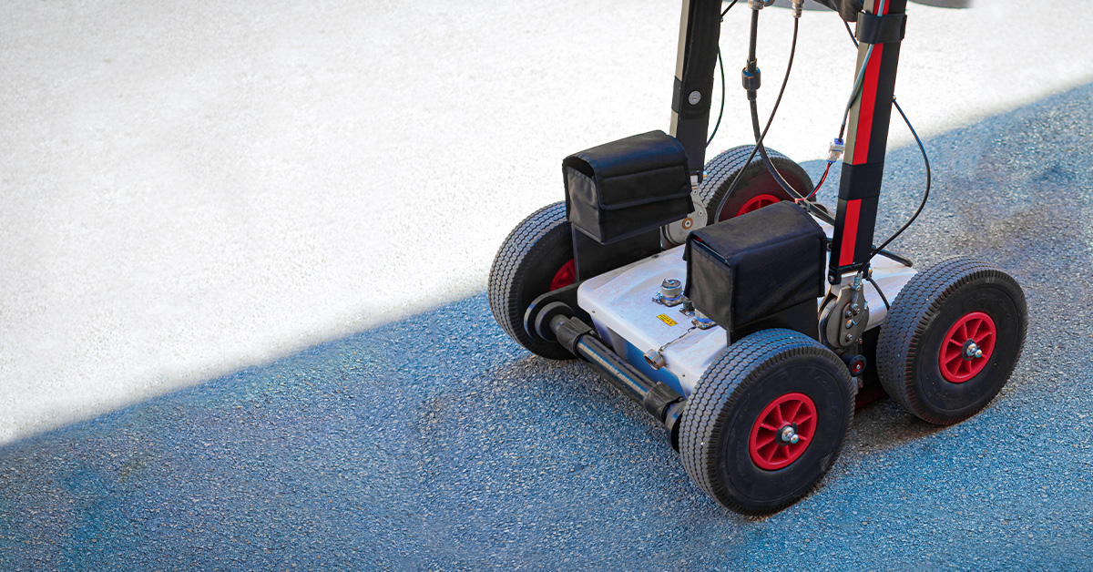
In this pilot, we conducted mapped subsurface utilities in a highly complex and densely urbanized area in Saudi Arabia. The site has been under continuous development for over 50 years and represents a particular cultural and heritage importance for the kingdom. The survey employed three-dimensional Ground Penetrating Radar (GPR) techniques with advanced shielding and signal processing to address the challenges related to VHF communication noise and electromagnetic interference caused by the surrounding area.
Location Challenges: The area is situated between multiple elevated topographies, creating a basin-like effect that causes electromagnetic waves to reflect and bounce-back, complicating the detectability of subsurface features.
Electromagnetic Noise: High levels of coherent and uncoherent VHF communication noise further hinder data acquisition, rendering previous surveys by multiple companies unsuccessful.
Methodology: To overcome these challenges, we performed a three-dimensional multiple frequencies radargrams at the bands 270,400, and 900 MHz. Our pilot grid was 400 square meters with a 1 × 1 m grid spacing. We used enhanced shielding and coupling to mitigate noise and interferences. Removal of coherent VHF noise using trace averaging over 50 traces. We also applied several signal processing and migration techniques to identify and distinguish the different utilities networks whether active or non-active.
- Results & recommendations: The pilot study demonstrated that the applied noise isolation techniques and frequency configuration significantly improved the quality of the acquired data. Deeper and larger subsurface features associated with utilities were successfully identified, as shown in the processed data (Figure 2). Our data underscores the importance of customized geophysical methods and advanced data processing in overcoming the challenges of subsurface utilities mapping in complex urban environments. The proposed solutions promise significant advancements in the accuracy and efficiency of such surveys, paving the way for effective infrastructure maintenance and development in the region. Based on the pilot study’s success, ARGAS proposes the following to the client to Utilize a customizable vehicle-mounted, multi-channel GPR system to scale the survey across the entire site. We also deduced that Single-operated GPR units available in the local market are potentially inadequate for achieving the required coverage and accuracy. Finally, employing machine learning and artificial intelligence algorithms to automate data processing and improve the detectability of utilities is crucial to identify subsurface artifacts in large-scale surveys.
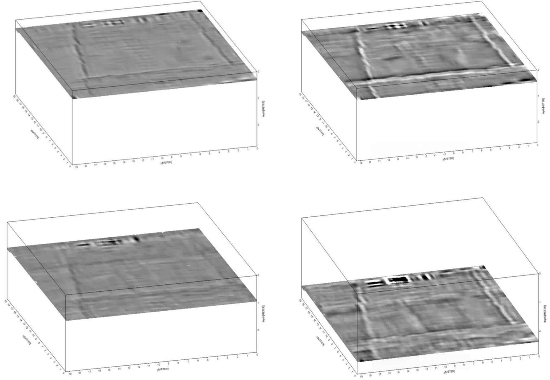
Figure 1. Three-dimensional reconstruction of the subsurface of the pilot site at different depths from 0 to 2.5 m showing different subsurface assets.
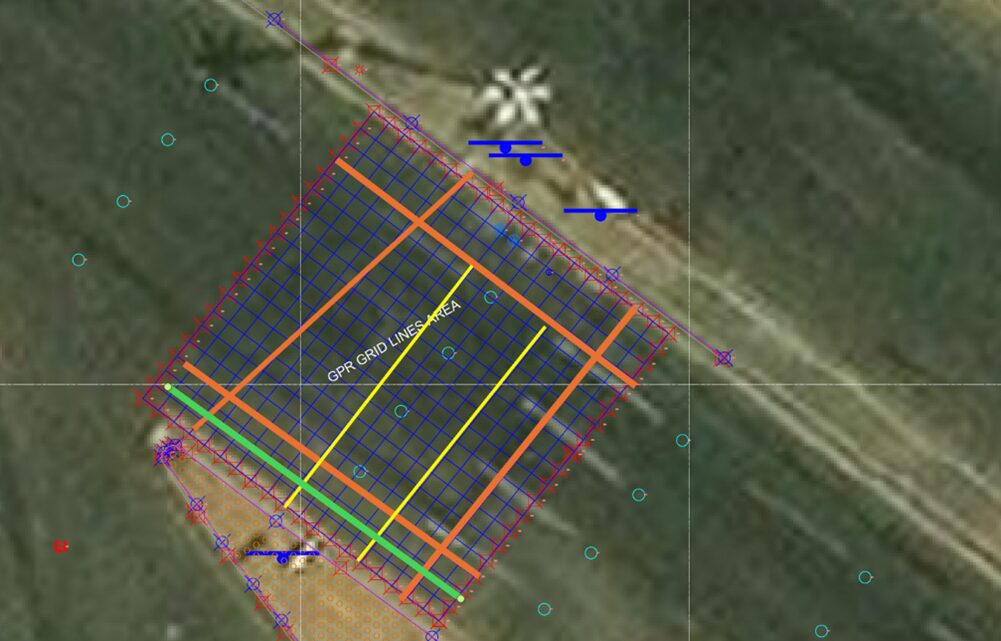
Figure 2. Interpreted subsurface asset identification based on the GPR data of the Pilot site.
Geotechnical Account Manager at ARGAS
Ahmed Abd El Wahab
